watch in order
http://www.youtube.com/watch?v=zzRYxSScQGk
http://www.youtube.com/watch?src_vid=zz ... L92Lsv3-SE
http://www.youtube.com/watch?v=V5QD6D9pYfE (skip to 4:18)
and boom.
Another way for real height map elevation. (need 3ds)
-
barrington314
- Posts: 6614
- Joined: Fri Feb 18, 2011 6:03 pm
- Team: me
- Location: Charleston, SC
Re: Another way for real height map elevation. (need 3ds)
sorry for the noob question but after you render if, then what? save that render as terrain.png and move to track folder? surely it cant be that easy.

Re: Another way for real height map elevation. (need 3ds)
nope thats it. just have to crop the image and resize it to 1024x1024barrington314 wrote:sorry for the noob question but after you render if, then what? save that render as terrain.png and move to track folder? surely it cant be that easy.

Re: Another way for real height map elevation. (need 3ds)
Its a nice method and i would probably use it if it wasn't for a few things, 1, how do you get the ortho image 2, how do you get the scale correct in game of both the terrain and ortho? 3, Is there not a way to render the gradient part to a texture at the same size as your terrain so it wouldn't need scaling?

-
barrington314
- Posts: 6614
- Joined: Fri Feb 18, 2011 6:03 pm
- Team: me
- Location: Charleston, SC
Re: Another way for real height map elevation. (need 3ds)
well it doesnt work for me. and i read were someone else was having problems getting a terrain png working with the blank updated track as well. i even tried taking a terrain png from another track and putting it in blank updated with no luck.pulse wrote:nope thats it. just have to crop the image and resize it to 1024x1024barrington314 wrote:sorry for the noob question but after you render if, then what? save that render as terrain.png and move to track folder? surely it cant be that easy.
-
SCHAFFERNOCKER
- Posts: 559
- Joined: Thu Dec 02, 2010 2:33 am
- Team: blank
Re: Another way for real height map elevation. (need 3ds)
I was working on a track a few weeks ago, and I couldnt get the damn Terrain.png to work either. I even tried the same technique, steal it from another blankupdated folder. Then I created a new terrain.png brushed it a few times to try and get some hills. Opened up in MXS, nothing. It was still the blank terrain. So I quit, going to give it a few and take another go at it.barrington314 wrote:well it doesnt work for me. and i read were someone else was having problems getting a terrain png working with the blank updated track as well. i even tried taking a terrain png from another track and putting it in blank updated with no luck.pulse wrote:nope thats it. just have to crop the image and resize it to 1024x1024barrington314 wrote:sorry for the noob question but after you render if, then what? save that render as terrain.png and move to track folder? surely it cant be that easy.
-
barrington314
- Posts: 6614
- Joined: Fri Feb 18, 2011 6:03 pm
- Team: me
- Location: Charleston, SC
Re: Another way for real height map elevation. (need 3ds)
let me know if you figure it out. this was a super easy way to get the height data. but idk how its going to look in game yet. and i only have a 30 day trial for 3ds. 
Re: Another way for real height map elevation. (need 3ds)
Isn't the terrain size meant to be 1025x1025?barrington314 wrote:well it doesnt work for me. and i read were someone else was having problems getting a terrain png working with the blank updated track as well. i even tried taking a terrain png from another track and putting it in blank updated with no luck.pulse wrote:nope thats it. just have to crop the image and resize it to 1024x1024barrington314 wrote:sorry for the noob question but after you render if, then what? save that render as terrain.png and move to track folder? surely it cant be that easy.
Re: Another way for real height map elevation. (need 3ds)
if your track is comming up flat its because of your terrian.hf file, open it up with notepad++ and the far right numer is the hight scale. so play wound with that, And people wonder about the right scale, you can change the scale over all in the terrian.hf.
and the real hight data just there to help in the elivation, its not a 100% you would have to mess with it a bit to get it right.
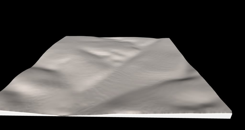
heres the Compound hight map elivation

and the real hight data just there to help in the elivation, its not a 100% you would have to mess with it a bit to get it right.
heres the Compound hight map elivation
Re: Another way for real height map elevation. (need 3ds)
a different way to extract height maps from sketchup without using 3dsmax.
http://www.ls-uk.info/forum/index.php?topic=97248.0
http://www.ls-uk.info/forum/index.php?topic=97248.0
Re: Another way for real height map elevation. (need 3ds)
Thanks, just got the terrain and ortho image for the matterley basin track using this method, now i have to get it in the game as a decal.pulse wrote:nice find
Re: Another way for real height map elevation. (need 3ds)
Cool method, I like how you can see how the terrain looks before grabbing it so you know if it's worthwhile or not  .
.
I actually don't use the method in the tutorial I made anymore, since you have to find what county it's in which might not be listed. I use the method Haggqvist taught me with the Seamless Data Warhouse http://seamless.usgs.gov/. I'll have to try this method out though, it's a lot easier to find the area you're looking for by searching instead of starting out zoomed out over the whole U.S. and manually zooming trying to find it (plus it's only U.S. data).
I actually don't use the method in the tutorial I made anymore, since you have to find what county it's in which might not be listed. I use the method Haggqvist taught me with the Seamless Data Warhouse http://seamless.usgs.gov/. I'll have to try this method out though, it's a lot easier to find the area you're looking for by searching instead of starting out zoomed out over the whole U.S. and manually zooming trying to find it (plus it's only U.S. data).
TeamHavocRacing wrote:If I had a nickel for every time someone asked for this, I would have a whole shitload of nickels.
Re: Another way for real height map elevation. (need 3ds)
glad you liked it, your method was too hard for me So I started to look around and Since I was making a game in the cry engine I deiced why not 3ds max and google maps!?!?! and I found this.
Re: Another way for real height map elevation. (need 3ds)
The terrain hf in blank up dated has not got the right numbers so take the one from the blank track and put it in blank updated.barrington314 wrote:well it doesnt work for me. and i read were someone else was having problems getting a terrain png working with the blank updated track as well. i even tried taking a terrain png from another track and putting it in blank updated with no luck.pulse wrote:nope thats it. just have to crop the image and resize it to 1024x1024barrington314 wrote:sorry for the noob question but after you render if, then what? save that render as terrain.png and move to track folder? surely it cant be that easy.
cr500zd wrote:is there anyway that 500cc bikes will be put into the game?jlv wrote:I'd say it will definitely happen at some point. Not any time soon though.