Hmmm I seem to be having this problem. But without the error message.John23 wrote:I have found out how to get the plugin working, but when I do the model to height map, I name it "Mountainview.bmp" and set the location to my desktop. Once I get the window that says it was completed, there is nothing but an empty folder on my desktop and it gives me an error saying it no longer exists.
How-To: Create Replica Track Height Map (Sketchup Method)
-
barrington314
- Posts: 6614
- Joined: Fri Feb 18, 2011 6:03 pm
- Team: me
- Location: Charleston, SC
Re: How-To: Create Replica Track Height Map (Sketchup Method)

Re: How-To: Create Replica Track Height Map (Sketchup Method)
All the height maps were located in my documents folder for some reasonbarrington314 wrote:Hmmm I seem to be having this problem. But without the error message.John23 wrote:I have found out how to get the plugin working, but when I do the model to height map, I name it "Mountainview.bmp" and set the location to my desktop. Once I get the window that says it was completed, there is nothing but an empty folder on my desktop and it gives me an error saying it no longer exists.
jlv wrote:This post is useless.
-
barrington314
- Posts: 6614
- Joined: Fri Feb 18, 2011 6:03 pm
- Team: me
- Location: Charleston, SC
Re: How-To: Create Replica Track Height Map (Sketchup Method)
Dang, mine too. Thats weird. Yay! Thank you sir.John23 wrote:All the height maps were located in my documents folder for some reasonbarrington314 wrote:Hmmm I seem to be having this problem. But without the error message.John23 wrote:I have found out how to get the plugin working, but when I do the model to height map, I name it "Mountainview.bmp" and set the location to my desktop. Once I get the window that says it was completed, there is nothing but an empty folder on my desktop and it gives me an error saying it no longer exists.
Re: How-To: Create Replica Track Height Map (Sketchup Method)
when i open the map to select a region its not a satulite picture and when i grab it and then click on toggle terrain it doesnt do anything at all?
Re: How-To: Create Replica Track Height Map (Sketchup Method)
it won't let me do anything with the 2013 version anymore so i had to get the 2017 version, but in this version they somehow made it worse than the older one because now there is no plugins folder. so now i can't put the mesh2heightmap thing in it, so now i can't do shit.
kinda frustrating when a company goes ahead and makes their new version of their program worse than their old, then forces you to use the new version or else your fucked. beautiful, true heroes they are.
kinda frustrating when a company goes ahead and makes their new version of their program worse than their old, then forces you to use the new version or else your fucked. beautiful, true heroes they are.
James_122 wrote:The old folks home should limit you fossils on how much internet time you get a day. Hopefully they mashed your turkey meat up enough so you can chew it.

Re: How-To: Create Replica Track Height Map (Sketchup Method)
Go to extension manager or whatever, click on install and locate the .rbz file.808 wrote:it won't let me do anything with the 2013 version anymore so i had to get the 2017 version, but in this version they somehow made it worse than the older one because now there is no plugins folder. so now i can't put the mesh2heightmap thing in it, so now i can't do shit.
kinda frustrating when a company goes ahead and makes their new version of their program worse than their old, then forces you to use the new version or else your fucked. beautiful, true heroes they are.
Discord: StorkeN#6883 - StorkenMXS Youtube - StorkenMXS Instagram - StorkenMXS Facebook - TMFR on Faceboook

Re: How-To: Create Replica Track Height Map (Sketchup Method)
it's not an rbz fileWahlamt wrote:Go to extension manager or whatever, click on install and locate the .rbz file.808 wrote:it won't let me do anything with the 2013 version anymore so i had to get the 2017 version, but in this version they somehow made it worse than the older one because now there is no plugins folder. so now i can't put the mesh2heightmap thing in it, so now i can't do shit.
kinda frustrating when a company goes ahead and makes their new version of their program worse than their old, then forces you to use the new version or else your fucked. beautiful, true heroes they are.
James_122 wrote:The old folks home should limit you fossils on how much internet time you get a day. Hopefully they mashed your turkey meat up enough so you can chew it.
Re: How-To: Create Replica Track Height Map (Sketchup Method)
Go to page 2 here and download it (puma linked it I think).808 wrote:it's not an rbz fileWahlamt wrote:Go to extension manager or whatever, click on install and locate the .rbz file.808 wrote:it won't let me do anything with the 2013 version anymore so i had to get the 2017 version, but in this version they somehow made it worse than the older one because now there is no plugins folder. so now i can't put the mesh2heightmap thing in it, so now i can't do shit.
kinda frustrating when a company goes ahead and makes their new version of their program worse than their old, then forces you to use the new version or else your fucked. beautiful, true heroes they are.
Discord: StorkeN#6883 - StorkenMXS Youtube - StorkenMXS Instagram - StorkenMXS Facebook - TMFR on Faceboook
Re: How-To: Create Replica Track Height Map (Sketchup Method)
gee, thanksWahlamt wrote:Go to page 2 here and download it (puma linked it I think).808 wrote:it's not an rbz fileWahlamt wrote: Go to extension manager or whatever, click on install and locate the .rbz file.
James_122 wrote:The old folks home should limit you fossils on how much internet time you get a day. Hopefully they mashed your turkey meat up enough so you can chew it.
Re: How-To: Create Replica Track Height Map (Sketchup Method)
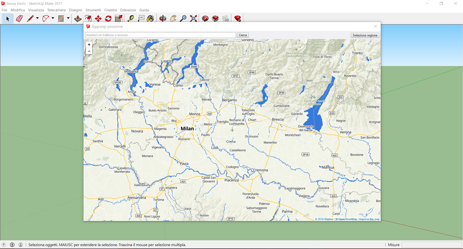
How can i fix this, if it's possible? After the last update the program is using this kind of "urban" map instead of the usual satellite map and now it's impossible to export the height map correctly...
Gabriele Grossi #22 | RKI JayDeeSounds Italia Racing Team
Trackmaker, PM me to get your favourite track done at reasonable prices!
If you like my works --> https://www.paypal.me/Gabrielegrossi
Trackmaker, PM me to get your favourite track done at reasonable prices!
If you like my works --> https://www.paypal.me/Gabrielegrossi
Re: How-To: Create Replica Track Height Map (Sketchup Method)
I may have a new way to get real terrain data, but Ill have to buy some software.
Does anyone know of a method that currently works? Seems as though the one I wrote up a few years ago no longer works due to Google giving us the shaft.
Does anyone know of a method that currently works? Seems as though the one I wrote up a few years ago no longer works due to Google giving us the shaft.

-
ColtonD719
- Posts: 631
- Joined: Tue Jun 21, 2016 4:15 am
- Team: Privateer
- Location: Oregon
- Contact:
Re: How-To: Create Replica Track Height Map (Sketchup Method)
From this thread: http://forum.mxsimulator.com/viewtopic. ... 19#p815812aeffertz wrote:Does anyone know of a method that currently works?
ColtonD719 wrote:Unfortunately, Jakob is correct that SketchUp has been "updated" so that you have to have the Pro version to get terrain data, and even worse, the data is way lower resolution than it used to be. Basically, SketchUp is worthless for this now, IMO. Which sucks because it used to be pretty easy/good quality.
The only way I know of to get good quality terrain data now, aside from going out there with a drone, is using DEMs. There is some helpful discussion on it here: http://forum.mxsimulator.com/viewtopic.php?f=11&t=8845
Beware, it can be confusing AF. Definitely read down the thread, especially Haggvist's posts.
First you have to find the DEM (height data) and ortho (satellite imagery) that covers the area where your track is located. I don't know about international sources, but for the US, the National Map is very useful: https://viewer.nationalmap.gov/basic/#startUp (Search for "Elevation Products (3DEP)" and "Imagery (NAIP)" in the area of your track.)
Download the highest resolution DEM and ortho available and open them in a program such as Microdem or QGIS (I use QGIS since it is available for Mac). In these programs, you should be able to align your height data and satellite image based on the coordinates embedded in the metadata of the files. Then, zoom in to the part of the map that you want to use in game, and export the height data as 16 or 32-bit grayscale, and export the satellite image as color. You can then open the images in Photoshop/GIMP and convert the grayscale to 16-bit (if it's not already), and proceed to work on them as normal.
Once I get a better grasp of exporting things from QGIS I'd like to make a more detailed tutorial, but I haven't quite learned it 100% yet.
Hope that helps! Unfortunately since the new SketchUp it's a way more complicated process, but definitely still possible.

-
ColtonD719
- Posts: 631
- Joined: Tue Jun 21, 2016 4:15 am
- Team: Privateer
- Location: Oregon
- Contact:
Re: How-To: Create Replica Track Height Map (Sketchup Method)
BTW, a lot of The National Map data is actually a lot higher resolution than what was available via sketch up, it's just not as convenient to access.
-
Fabio Guido
- Posts: 127
- Joined: Tue Nov 21, 2017 10:47 am
- Team: Hitcase
- Contact:
Re: How-To: Create Replica Track Height Map (Sketchup Method)
When i use the plugin "model to heightmap" it say me "This is not an orthograpic view. Aborting ..."
I've select the Top view ^^
I've select the Top view ^^
Re: How-To: Create Replica Track Height Map (Sketchup Method)
You have to un-tick "perspective" also, under the camera menu.Fabio Guido wrote:When i use the plugin "model to heightmap" it say me "This is not an orthograpic view. Aborting ..."
I've select the Top view ^^
Gabriele Grossi #22 | RKI JayDeeSounds Italia Racing Team
Trackmaker, PM me to get your favourite track done at reasonable prices!
If you like my works --> https://www.paypal.me/Gabrielegrossi
Trackmaker, PM me to get your favourite track done at reasonable prices!
If you like my works --> https://www.paypal.me/Gabrielegrossi